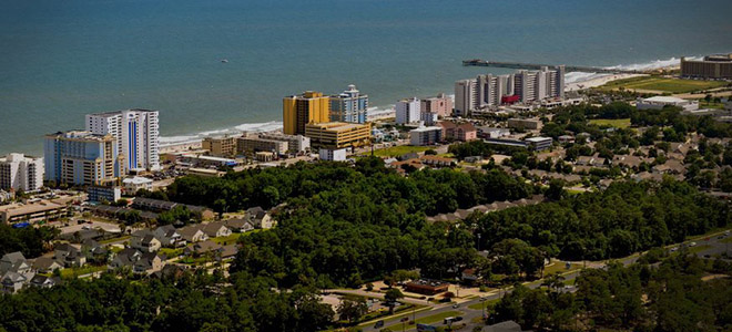
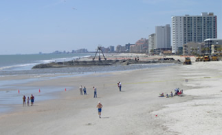
Coastal Science & Engineering is pleased to announce that three of its engineers earned Professional Engineer licensing in December 2009.
Congratulations to Brooke Fassnidge, Daniel Johnson, and Doug Dusini.
|
||||||||||||||||
|
Coastal Science & Engineering is pleased to announce that three of its engineers earned Professional Engineer licensing in December 2009. Congratulations to Brooke Fassnidge, Daniel Johnson, and Doug Dusini.
New pictures of the RV Congaree River and her crew have been added to our Data Collection page! Ten years ago, CSE was invited by Carteret County to assist the Beach Preservation Task Force in developing a shoreline erosion assessment and beach restoration plan for Bogue Banks. The impetus for the plan was a succession of five hurricanes between 1996 and September 1999. Within four months, CSE completed the first comprehensive beach and inshore survey of the island, located several viable sand borrow areas, and prepared a preliminary design and estimate of construction costs for beach nourishment along 16.8 miles encompassing the towns of Pine Knoll Shores (PKS), Indian Beach and unincorporated Salter Path (IBSP), and Emerald Isle (EI). By April 2002, Phase I of CSE’s three-phase, $32 million plan was complete along Pine Knoll Shores and Indian Beach/Salter Path. It was followed one year later by Phase II encompassing east and central Emerald Isle. CSE also prepared the Phase III concept plan and preliminary design for realignment of the Bogue Inlet channel and restoration of western Emerald Isle. Final design and implementation of Phase III was completed by another firm in 2005. The Carteret County beach restoration project was pioneering in a number of ways:
The keys to rapid implementation of Phases I and II of the County plan were timely field data collection, preparation of a credible and understandable (to the community) plan, close coordination with regulatory and resource agencies during the NEPA/NCEPA process, and strong local leadership in support of the plan. Since the first phase of the County beach restoration project was completed (April 2002), there have been a total of 11 nourishment events (~10.3 million cubic yards) along Bogue Banks. This is the equivalent of ~80 cy/ft added along the entire length of the island. As the before and after photos show, Bogue Banks today has a much healthier beach; property owners have not had to rebuild dune walkovers or scrape the beach each year; and new vegetation is stabilizing the foredune. The plan that CSE laid out for Bogue Banks in 1999 has stood the test of time. Over 85 percent of the nourishment volumes placed between 2001 and 2007 along Pine Knoll Shores, Indian Beach/Salter Path, and Emerald Isle remained in place as of 2008. CSE is proud to have played a central role in restoring the Bogue Banks beach, reducing storm damages, and enhancing the tax base of three municipalities on the island. We thank county officials and citizens of Bogue Banks for their support over the past decade. ![]() Washington, NC Waterfront Promenade and Marina CSE recently completed the design and permitting for the Washington (NC) Waterfront Promenade and Marina. This municipal project on the Pamlico River added 48 wet slips to accommodate yachts up to 80 feet long. Services provided by CSE included design of wastewater disposal and marine power systems, fixed timber docks and a ferry landing. Construction is finished and the project is fully operational, making the Washington Waterfront one of the most attractive destinations for boaters along the western shore of Pamlico Sound. Click here for more information on CSE Waterfronts and Marinas. For over 25 years, CSE has assisted Sasaki Associates (Boston) with coastal engineering in connection with large waterfront developments. Some recent projects include wave and flow modeling for the Daniel Island Marina in Charleston (SC) and a flushing study for a proposed marina in Panama City (FL). For the Daniel Island Marina, CSE collected detailed bathymetry in the lower Wando River and measured tides, currents, turbidity, and discharge within the system using our complement of acoustic current meters, pressure gauges, and synoptic sampling gear. Time-series field data were used to calibrate the hydrodynamic model, RMA2, under USACE’s Surface Water Modeling System (SMS). Once calibrated, RMA2 was used to simulate flows and water levels under extreme events. Waves were calculated for 10-, 50-, 100-, and 500-year events for mid-tide and peak-tide conditions. The goal was to provide the marina designers with the range of hydrodynamic forces for the setting so they could optimize the design of piles and docks under Category 2 or Category 3 storm conditions. Isle of Palms is a 7-mile long, 1-mile wide barrier island off South Carolina’s coast in Charleston County. It is a blend of almost 5,000 fulltime residents, and 20,000 to 50,000 investment owners and visitors. The Wild Dunes Resort occupies 1,500 acres on the northeast end of the island, which includes two 18-hole Fazio golf courses. A July 2007 survey indicated that the condition of the beach at the northeast end was worse than at any time since May 1984. Sand volumes in this area had dwindled to an average of only 99 cubic yards per linear foot at low tide compared to the 1984 average of 123 cubic yards per linear foot, and even a peak in the late 90’s at 165 cubic yards per linear foot. The result was basically loss of any dry beach, and direct encroachment of the water on upland property. Erosion was so severe that emergency sand bags had been placed along nearly all properties in that area to protect building foundations. However, the bags have not been totally effective. CSE was hired to design and implement a beach renourishment project for this end of the Isle of Palms, to include a systematic and thorough removal of all sand bags in the project area. The plan called for up to 885,000 cubic yards of beach quality sand to be placed on the beach via hydraulic dredge, and removal of some 9,000 sand bags. Weeks Marine, Inc. was contracted for the dredging, and CSE staff worked on the beach with them to analyze and dispose of the sand bags. The window of time permitted for the project was May 15, 2008 through July 31, 2008. Weeks Marine mobilized and began work on May 15th. The dredging operation ran 24-hour, 7 days a week, with sand bag removal running simultaneously roughly 9 hours a day for 6 days a week. Fork lifts and bobcats were on the beach lifting and disposing of sand bags, as staff slit and analyzed each bag’s content for appropriate disposal. Offshore, Weeks’ hydraulic dredge, the R.S. Weeks, pumped beach-quality sand from pre-approved borrow areas through 30-inch pipelines onto the shore, ultimately covering 10,200 linear feet of beach. All permit requirements for environmental concerns were met, with certified turtle teams monitoring the beach daily and successfully relocating 3 turtle nests during the project time frame. Weather conditions during the project period were ideal, with no major delays interrupting either offshore or onshore operations. One minor glitch did occur, however, in June, when a loud rattling noise came from the sand pipe on the beach and a ten-inch cannonball spilled out from the pipe onto the sand. CSE engineer and Project Manager for the Isle of Palms project, Brooke Fassnidge, was on the beach with Weeks personnel at the time and immediately cleared the area for the appropriate emergency and state officials to assess the situation. State Historian Richard Hatcher identified the cannonball as a Civil War munition that had been resting on the ocean floor for over 100 years. It was initially transported to Fort Sumter for cleaning and preparation for final transport to the SC Historic Preservation Office. Substantial completion of all operations was achieved on June 27, 2008, over a month ahead of schedule. Final completion was achieved on July 15th, still 2 weeks ahead of schedule. This was in no small part due to the dedicated and interdisciplinary team involved, with coordination and daily oversight by Brooke Fassnidge and Steven Traynum of CSE, and Doug Nelson of Weeks Marine. Isle of Palms was able to provide a wide, sandy beach to visitors for the better part of their summer season. A final total volume of 847,000 cubic yards of sand was placed on the beach, and a total of 9,401 sand bags removed. Environmental impacts were kept to a minimum, and plans for restoration of the famed 18th hole of the Links Golf Course are currently underway. Cannonball notwithstanding, it was a win-win project for all concerned! Arcadian Shores is a section of South Carolina’s Grand Strand between North Myrtle Beach and Myrtle Beach. It is home to Hilton Hotel Resort, Kingston Plantation, and several major residential towers. While the cities immediately north and south are part of a 50-year federal beach nourishment project, Arcadian Shores is not included. However, Horry County, which has jurisdiction over Arcadian Shores, with funding assistance from the state of South Carolina, has taken the initiative to maintain and improve the beach. Ten years ago, Horry County was able to “piggyback” the first nourishment of Arcadian Shores as the contractor was completing the project at Myrtle Beach. With a scheduled renourishment of Myrtle Beach and North Myrtle Beach by the Corps of Engineers in 2008, an opportunity presented itself for renourishment of Arcadian Shores. The challenge was obtaining permits on relatively short notice and accomplishing the project within a narrow environmental window. From start to finish in 11 months
Project Summary Construction was via two hopper dredges, Dodge Island and Padre Island, using a recently discovered deposit 1-3 miles offshore of the project area. Building on a reconnaissance survey by Coastal Carolina University, CSE obtained 56 borings using our in-house coring system and confirmed sediment quality to below-operational depths. The high density of cores allowed us to select dredging corridors having the most compatible sediments for the beach while avoiding cultural resources, hard bottom, and ongoing monitoring by state resource agencies. Hopper Dredge Advantages & Disadvantages The environmental advantages of shallow cuts via hopper dredge are offset by disadvantages during construction. Hopper dredges pose more of a threat to sea turtles than cutterhead dredges. As a result, work is severely restricted to just a handful of cold-water months under federal regulations. For Arcadian Shores, the allowable construction window was January through 31 March. Close Timing for the Project’s Completion
Performance Prediction Acknowledgments Owner: Horry County SC (c/o Steven Gosnell, Director, Public Works) Engineer: CSE Columbia SC (c/o Bill Forman Jr., PE, Doug Dusini, Philip McKee, Trey Hair, and Dr. Tim Kana) Contractor: Great Lakes Dredges & Dock Company (c/o Steve Auernhamer) After 13 years on Devine Street, CSE moved to new quarters at 160 Gills Creek Parkway on August 1st. The new office gives us some much-needed space so we can accommodate new staff and store all our field equipment (which has expanded as our firm has grown). Watch for an announcement of our open house later in fall 2007. (It will take us a couple of months to unpack over 20 years’ worth of reports and archives from our 400+ projects over the years.) ![]() CSE Columbia's new office Our phone numbers and normal mailing address remain the same. Overnight shipping address changes to 160 Gills Creek Parkway Columbia SC 29209. Thank you for your patience earlier in August as we made the move and temporarily lost communication with you. Three CSE beach nourishment projects were completed in record time between April 1st and July 31st. Thanks to cooperating weather, efficient contractors, and timely decisions by state and federal regulators, visitors to Edisto Beach, Hunting Island, and Kiawah Island will enjoy wider beaches for the remainder of the season. ![]() Edisto Island, after nourishment (2006 Jun 06) Edisto Beach Renourishment Project ![]() Hunting Island - after nourishment (June 2006) Hunting Island Renourishment Project ![]() Kiawah Island - after nourishment (July 2006) Kiawah Island Inlet Relocation Project ![]() CSE's principal research vessel, the Irie ![]() Irie's 2-inch pump goes to work ![]() The Fishing Taxi, sinking fast ![]() CSE's principal research vessel, the Irie CSE helped save the sportfishing vessel, Fishing Taxi, out of Oregon Inlet (NC) on July 7th. “We were on our way out of the inlet to continue offshore coring for the Town of Nags Head when we heard a mayday,” according to Philip McKee, CSE’s captain. The ~40-ft Fishing Taxi, with six passengers on board, was taking on water and sinking fast. It may have struck an unmarked wreck on the north side of the inlet. Philip, along with the crew of CSE’s RV Irie, were alongside in ten minutes, offering to pump out the vessel with our deck-mounted water pump. By this time, the Fishing Taxi had offloaded its passengers to another charter boat and was under tow toward the main channel. However, without power for its own pumps, water was well over the cockpit flooring. Trey Hair and Doug Dusini, on board Irie, passed over the 60-ft hose and started up our pump. Philip kept Irie alongside Fishing Taxi while the 2-inch pump sucked up about 50 gallons per minute. “We kept this up for about 15 minutes until the Coast Guard arrived with an even bigger pump.” Around 7:30 a.m., RV Irie left the scene and proceeded to the sand search area off Nags Head. Despite losing an hour during prime conditions for ocean work that day, the crew of the Irie was able to complete the day’s tasks. Plus our staff had satisfaction of knowing that Irie and the other boats that assisted in the rescue bought valuable time until the Coast Guard could arrive on the scene. “What do you think are the chances of being in a sinking boat and having a vessel like the Irie with a water pump and 60-ft hose show up ten minutes later?” Philip remarked as they left the scene. Trey and Doug said the captain of Fishing Taxi appeared much less stressed by the time Irie left the scene. CSE’s 22-ft C-Dory and its crew continue to do extraordinary things in service to fellow boaters as well as clients. Thanks Philip, Trey, and Doug for a job well done! |
||||||||||||||||
|
Copyright © 2010 Coastal Science & Engineering - All Rights Reserved |
||||||||||||||||